
Questions Worth Asking Before Committing to a Neighbourhood

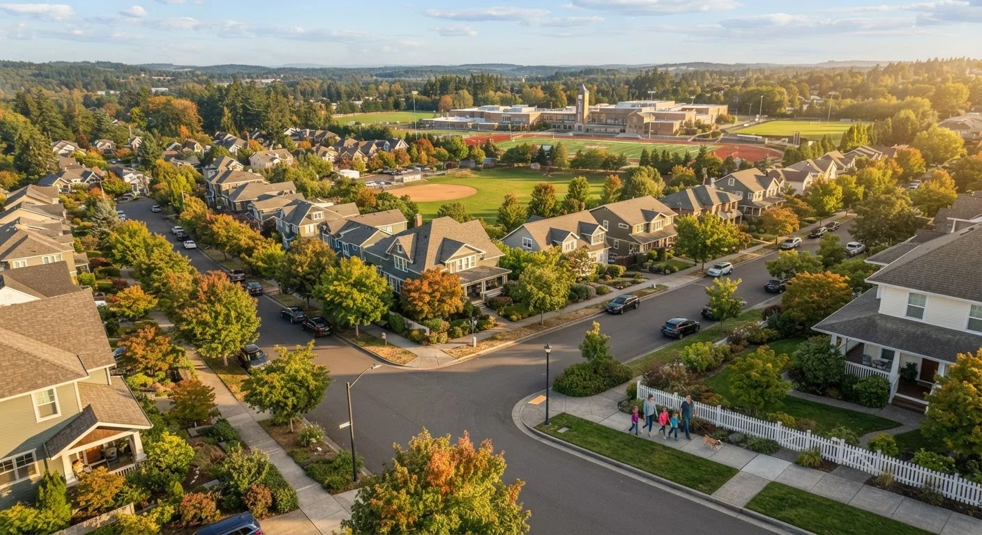
Photo: faqsvault.com editorial
Key Takeaways
- School district boundaries affect property values even for households without school-age children.
- Flood zone designation and insurance costs can significantly affect the true cost of ownership or renting.
- Planned development and zoning changes can transform a neighbourhood's character within a few years.
- Commute time and transit access are often underestimated factors in long-term satisfaction.
- Walking the neighbourhood at different times of day reveals what online research cannot.
Why the Neighbourhood Matters as Much as the Home
A well-designed floor plan and updated kitchen can lose their appeal quickly if the surrounding neighbourhood doesn't fit your daily life. Whether you're deciding to rent or buy, the community you move into shapes your commute, your kids' education, your insurance premiums, and your long-term financial position in ways that a home inspection alone will never reveal.
The challenge is knowing what to look for before you sign anything. Many buyers and renters focus almost entirely on the property itself, only to discover later that a new highway is planned two blocks away, or that the school zone boundary runs through the middle of the street. This checklist is designed to close that gap.
For guidance on what to examine about the property itself before committing, see our pre-purchase checklist for buyers. The questions below focus specifically on the neighbourhood surrounding it.
Which school district does this address fall in?
School district boundaries don't always follow intuitive geographic lines. Two homes on the same street can feed into entirely different districts depending on which side of the boundary they sit. This matters even if you don't have children — district quality is consistently one of the strongest predictors of residential property values over time.
You can verify district assignment through your state's department of education website or the district's own enrollment office. Don't rely solely on a listing agent's description; confirm the specific address in writing. Also check whether the school a child would attend is the neighbourhood school or a magnet or choice program that requires a separate application.
Two homes on the same street can fall into entirely different school districts — always verify by address.
What is the flood zone designation, and what would insurance cost?
FEMA's National Flood Insurance Program maps much of the country into flood zones ranging from minimal risk to high-risk Special Flood Hazard Areas. If a property sits in a high-risk zone, lenders typically require flood insurance as a condition of the mortgage — an additional annual cost that can run from a few hundred to several thousand dollars depending on the property and its elevation.
You can look up any address on FEMA's Flood Map Service Center. Beyond current maps, ask locally whether the area has experienced street-level or basement flooding during heavy rain events, as mapped risk doesn't always capture real-world drainage behaviour. This is especially relevant in areas where older stormwater infrastructure struggles with increasingly intense weather.
Flood insurance requirements can add thousands of dollars annually to the true cost of ownership.
What development is planned or permitted nearby?
A quiet lot next door today could be a mid-rise apartment building or a distribution warehouse in three years. Local planning and zoning offices maintain public records of approved developments, rezoning applications, and comprehensive land use plans. These are public documents and most municipalities post them online or make them available on request.
It's also worth attending a local planning commission meeting or reviewing recent meeting minutes. These sessions surface proposed projects that haven't yet been decided — giving you a clearer picture of where a neighbourhood is headed, not just where it stands today. Zoning changes can work in either direction: a new transit stop may improve values, while industrial rezoning can do the opposite.
Local planning records reveal approved and proposed developments that can fundamentally change a neighbourhood.
What does the real commute look like — at rush hour?
Distance is a poor proxy for commute time. A 10-mile route through a congested corridor during peak hours can take longer than a 25-mile highway commute in a less congested area. Before committing to a neighbourhood, make the actual trip at the time of day you would be travelling — by car, transit, or bike — rather than estimating from a mapping app's default settings.
Also research transit frequency and reliability independently. Bus or train schedules that look adequate on paper can mean very different things in practice if service is infrequent or prone to delays. If remote work is part of your plan, verify broadband infrastructure rather than assuming — particularly in older suburbs or rural-adjacent areas where fibre coverage may be uneven.
Make the actual commute at rush hour before deciding — distance alone tells you very little.
What do noise, traffic, and activity look like at different times?
A neighbourhood visit on a sunny Sunday afternoon gives an incomplete picture. Flight paths, freight routes, weekend nightlife, and early-morning deliveries are all things you'll only discover by visiting at varied times — a weekday morning, a Friday evening, and a late weekend night if possible.
Talk to people you encounter: dog walkers, people gardening, anyone spending time outside. They'll often share candid observations that open listings and neighbourhood branding won't. This kind of on-the-ground intelligence is difficult to replicate through any data source and consistently shows up as one of the most useful steps for buyers and renters who later report being satisfied with their choice.
Visit on a weekday morning, a Friday evening, and a weekend night to see the full picture.
How stable or changing is the local employment base?
Neighbourhood character and property values are tightly linked to local economic health. Areas anchored by a single large employer — a university, a military base, a major manufacturer — can be vulnerable to significant disruption if that employer downsizes or relocates. Conversely, neighbourhoods with diversified local economies tend to be more resilient.
Local economic development office websites, regional chambers of commerce reports, and state labour statistics can provide context on major employers and employment trends. This is especially relevant if you're buying rather than renting, since your exit options if the local market softens are more constrained. For a deeper look at how employment access feeds into long-term value trends, see our overview of neighbourhood property value drivers.
Single-employer towns carry concentration risk — economic diversification supports more stable property values.
What is the condition of local infrastructure?
Roads, water systems, and public utilities in older neighbourhoods can carry deferred maintenance that eventually translates into higher municipal costs — and potentially higher property taxes or special assessments passed on to residents. Ask the local public works or utilities department about the age of the water and sewer lines serving the street. Check whether the area relies on a private well or septic system, which carry their own inspection and maintenance requirements.
Street condition is visible but sewer and water infrastructure is not. Some municipalities publish infrastructure condition assessments; others require a direct records request. If you're buying a home and planning improvements, knowing the right questions to ask contractors about service connections can also surface issues before work begins.
Ageing water and sewer infrastructure can lead to special assessments that surprise new residents years later.
Making a Decision You Can Live With
No neighbourhood is perfect, and the right trade-offs vary by household. A young professional may prioritise walkability and transit; a family with school-age children will weight district quality heavily; a remote worker might care most about internet reliability and outdoor access. The goal isn't to find a neighbourhood that scores perfectly on every dimension — it's to understand which factors matter most to you and verify them before committing.
Once you've moved in, connecting with neighbours and local civic groups can help you stay ahead of zoning changes and infrastructure plans. That sense of ongoing engagement matters more than most buyers expect. Our piece on building community connection in modern neighbourhoods explores practical ways to foster that from day one.
Property values are also shaped by many of the same factors explored here — schools, infrastructure, and employment access among them. If you'd like to understand how these dynamics affect long-term value, our analysis of neighbourhood property value drivers offers deeper context.
This article is for general informational purposes only and does not constitute financial, legal, or real estate advice. Individual circumstances vary; consult a licensed real estate professional, financial adviser, or attorney before making property decisions.
Use Public Data Sources First
All published content on this website is for informational and educational purposes only and should not be taken as professional advice. We recommend that readers seek expert opinion before making any decisions. The website is not responsible for any actions taken based on the information provided on this website. We are not liable for any inaccuracies, modifications, or omissions in information. Moreover, external links or third-party content are provided for convenience; we are not liable for their correctness. Users are advised to verify every piece of information before they use it for any purpose.